
Tropical Storm Helene puts Southwest Florida on alert
Expected to rapidly reach hurricane force strength
Trending
Communities around Southwest Florida and throughout the state are getting prepared for the potential impacts of Hurricane Helene.
According to the National Hurricane Center, Helene is expected to intensify and be near hurricane strength as it reaches the far northwestern Caribbean Sea early Wednesday.
NHC experts stated that “Helene is expected to rapidly intensify over the eastern Gulf of Mexico and be a major hurricane when it approaches
the northeastern Gulf Coast on Thursday. The risk of impacts from life-threatening storm surge and damaging hurricane-force winds continues to increase along the coast of the Florida Panhandle and the Florida west coast.”
Various counties throughout Florida are under hurricane watch, include Lee, Charlotte, and coastal Collier.
AccuWeather officials have forecasted a “powerful” Category 3 hurricane with maximum sustained wind gusts of 111-130 miles per hour to make landfall along the U.S. Gulf coast on Thursday. AccuWeather Lead Hurricane Expert Alex DaSilva said people along the Gulf coast from southwestern Florida to Louisiana need to closely monitor forecast updates.
"People on both the eastern and western sides of our forecast cone need to be prepared. Everyone in the Tampa Bay region should be ready for storm surge impacts, even if this storm stays well offshore," said DaSilva in a release. "We're closely monitoring a dip in the jet stream that is expected to cross over the Mississippi Valley this week. If it's a bit stronger and plunges farther south than what we are currently forecasting, it could pull the storm farther west toward Biloxi and Mobile. If the jet stream ends up being faster and a bit weaker, it could steer the storm farther east toward the Big Bend region of Florida."
The Lee County Board of County Commissioners held an emergency meeting Tuesday afternoon. County Commissioners voted to declare a State of Local Emergency, and announced that county offices will be closed Thursday.
Lee County Public Safety Director Ben Abes said based on the latest update from the NHC, said the county is expecting coastal surge in the vicinity of 3 to 5 feet, as well as tropical storm force winds.
“These winds will be different than Hurricane Debby, which was off of our coast,” Abes said. “Hurricane Debby was a primarily wind event on the barrier islands. This is going to blanket much of the county with those tropical storm force winds. These impacts are expected Thursday stating early morning between four and eight a.m. And they will end likely in the mid to late afternoon. So we’re looking at just a single day of impacts thankfully as the storm passes off to our west.”
Abes said he expects the Emergency Operations Center to activate to a Level 2 or partial activation Thursday morning.
“And we’ll be prepared to implement and emergency protective measures that are necessary response to the forecast or any changes that may occur,” Abes continued.
County officials have taken steps to open “safe havens” if necessary. If there was a significant change in the forecast that rose to the level of evacuations, county officials have been in talks with local schools and other facilities to roster staff if shelters need to be opened.
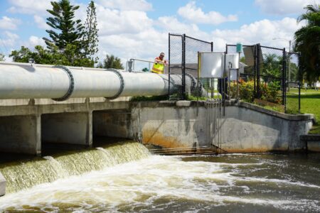
County officials said staff have been out and about checking weirs and water levels and culverts for obstructions to prevent flooding as much as possible.
County Commissioners and Abes discussed that if a resident is living in a coastal, low-lying, or flood-prone area, that those individuals should think about seeking shelter elsewhere.
Lee County will continue normal governmental operations on Wednesday but will close for normal operations on Thursday.
As the city of Cape Coral continues to monitor the tropics, officials encourage residents and local businesses to prepare for inclement weather.
"As we monitor the storm in the Gulf, it's crucial that every family in Cape Coral takes proactive steps to prepare while remaining calm,” said Mayor John Gunter is a statement. “Now is the time to gather supplies, review your emergency plans, and stay informed through official channels. By staying prepared and working together, we can protect our community and be ready for whatever comes our way this hurricane season."
Tips from Cape Coral officials include:
• Ensure you have enough food, water, and supplies on hand to sustain your household for 72 hours after a storm hits.
• Refrain from cutting trees, doing major yard work, or placing large amounts of bulk waste at the curb, as excess debris strains collection services.
• Secure loose items that could become projectiles before any approaching storm; this includes Waste Collection Totes.
• Waste collection schedules may change as storms approach; for updates and more information, follow www.facebook.com/CityofCapeCoral or visit capecoral.gov and check out the more news section for related press releases.
As of Tuesday, City Hall and ancillary offices plan to operate regular business hours on Thursday. Waste-Pro trash services will operate regular hours Thursday.
• Residents should sign up for Alert Lee to receive emergency messages directly to your cell phone. Register for free at www.alertlee.com.
• In the event of a City-wide outage (power, internet, cell-service, etc.) use your hand-crank radio to tune into B-103.9, and visit any Cape Coral fire station for emergency information.